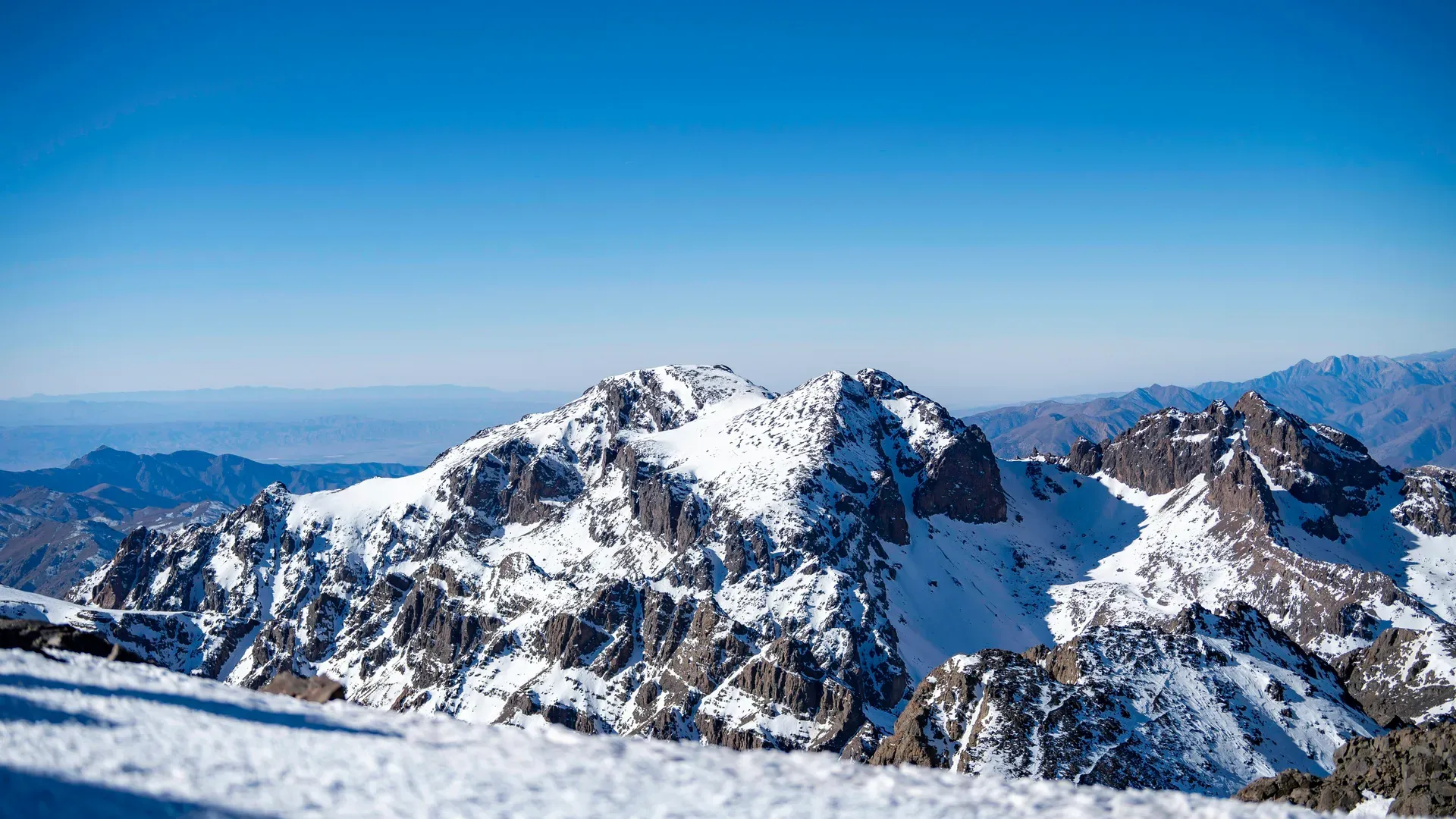
Mount Toubkal rises 4,167 meters above central Morocco as the highest peak in North Africa and the Arab world. The volcanic massif dominates Toubkal National Park, drawing hikers to its steep shale trails and freezing alpine summit.
Mount Toubkal dominates the High Atlas range at 4,167 meters above sea level. The peak stands 63 kilometers south of Marrakech, anchoring a massive volcanic rock formation that drops sharply into deep valleys. Hikers face a demanding two-day schedule to reach the summit. Day one requires a seven-hour, 10-kilometer hike from the base village of Imlil to the mountain refuge. Day two begins in complete darkness at 5:00 AM, demanding a four-hour vertical push to the peak, followed by an eight-hour descent back to Imlil. The trail transitions from terraced walnut and cherry orchards in the lower valleys to barren, loose shale scree above 3,000 meters. Climbers push through 40% less oxygen near the top, relying on the 'rest step' technique to lock their knees on the steep incline.
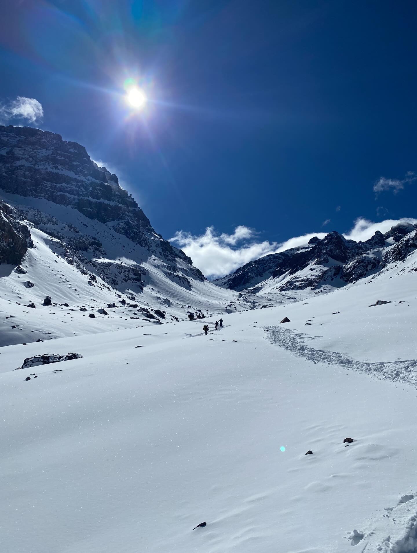
The mountain anchors Toubkal National Park, a protected zone covering high-altitude juniper forests and alpine meadows. Summer temperatures in Marrakech often exceed 100°F, but the Toubkal summit remains freezing before dawn. Winter ascents between November and March transform the route into a technical ice climb requiring crampons and ice axes. Hikers without proper gear risk hypothermia in the unheated mountain refuges. The rugged, steep, and rocky terrain consists of dirt paths, loose shale, and boulder fields, making it entirely inaccessible for wheelchairs and highly dangerous for young children.
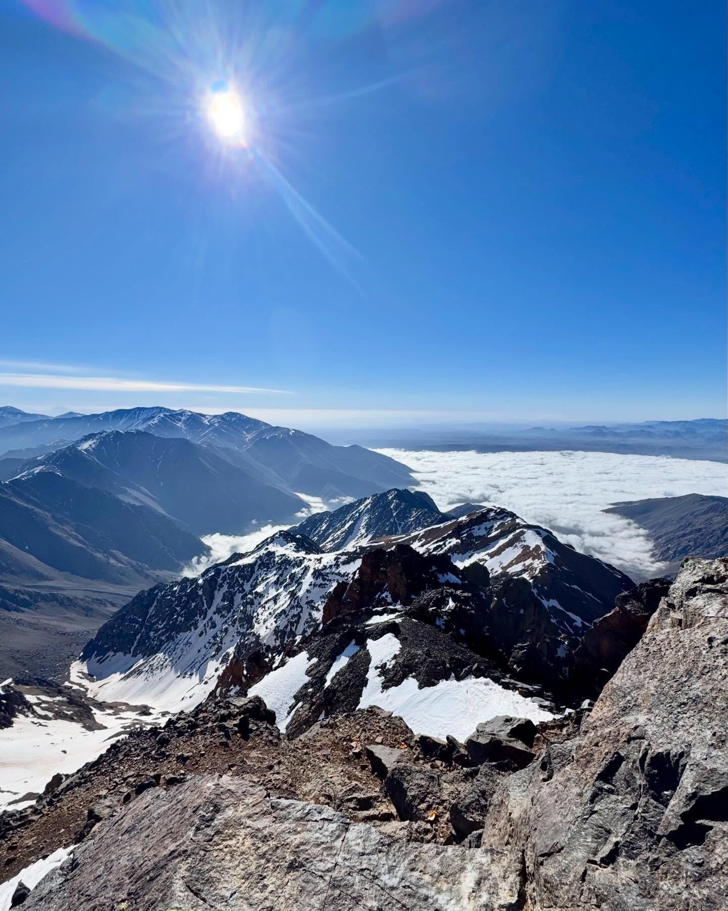
Reaching the peak reveals a massive metal trigonometric pyramid marking the highest point in North Africa. Climbers stand on the rocky crest at sunrise, looking out over snow-capped ridges that stretch toward the Sahara Desert. The descent punishes the knees as hikers slide down boulder fields and loose rock. Bring sturdy trekking poles to maintain balance on the 1,800-meter drop back to the valley floor.
Berber tribesmen and nomads have inhabited the valleys surrounding Mount Toubkal for over 10,000 years. These indigenous communities navigated the high passes and grazed livestock on the lower slopes long before recorded mountaineering history. Locals likely stood on the 4,167-meter summit centuries ago, though written records of these ascents do not exist. European exploration of the peak began in the early 20th century. French aviator and explorer Marquis René de Segonzac led the first officially documented European climb, reaching the top on June 12, 1923. His expedition mapped the upper reaches of the massif, paving the way for international alpine interest in the region.
The French Alpine Club constructed the first major mountain refuge on the slopes in 1938. This stone building, now known as the Neltner Refuge or CAF Toubkal Refuge, sits at 3,207 meters and opened the massif to global climbers. Climbers from around the world gather in the crowded dining hall to drink sweet mountain mint tea and eat hot tagine before sleeping in dormitory beds. Four years later, the Moroccan government established Toubkal National Park in 1942. The park boundaries protect the fragile alpine ecosystem from overgrazing and regulate the increasing flow of international trekkers. The protected area also encompasses nearby peaks like Ouanoukrim, the second-highest mountain in the region, which offers alternative alpine climbing routes.
A safety incident in 2018 prompted strict new regulations for all visitors. The Moroccan government made it illegal to climb Mount Toubkal without a licensed local guide. Police checkpoints now operate along the trail from Imlil, requiring guides to present their official credentials before groups can proceed. Hikers must also book overnight stays at the Neltner Refuge in advance, as the 90-bed dormitory fills quickly during the peak spring and autumn seasons. Independent climbers attempting to bypass these checkpoints face immediate turn-around by local authorities. Arrive in Marrakech at least one day before your hike begins to organize your mandatory guide and secure necessary permits.
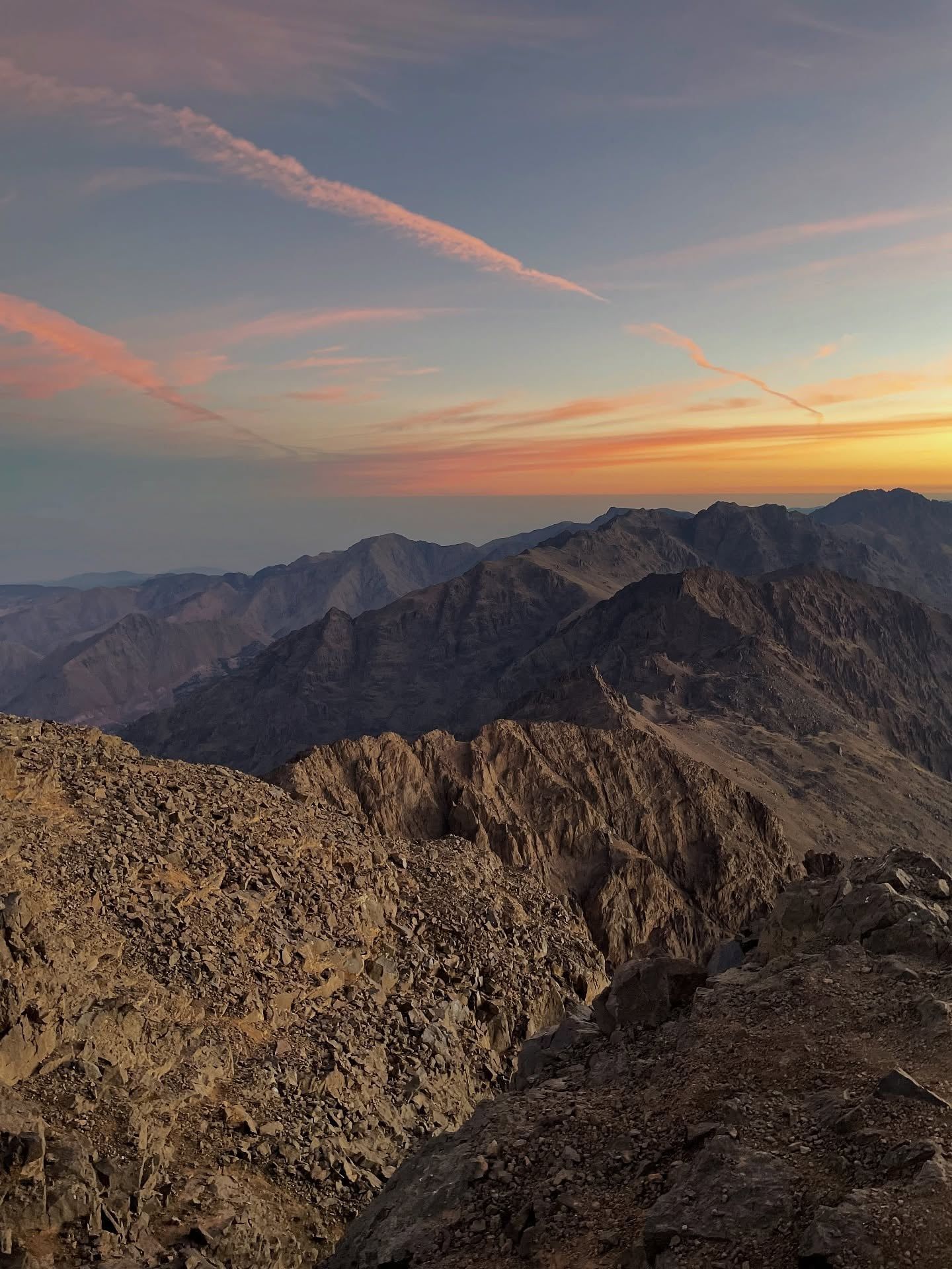
Volcanic rock formations define the Toubkal massif, setting it apart from the sedimentary rock found across much of the High Atlas. The mountain rises to a topographic prominence of 3,755 meters, ranking 27th globally in topographic isolation. Sharp alpine crests and steep cliffs dominate the upper elevations. The southern face drops a sheer 1,800 meters toward Lac d'Ifni, a high-altitude lake surrounded by towering basalt walls. To the west, the Tizi n'Ouanoums pass cuts through the rock at 3,664 meters, funneling harsh winds across the ridge. These geological features create a harsh, unforgiving environment that demands physical endurance.
The trail surface changes drastically as elevation increases. Hikers leave the dirt paths of Imlil and hit solid rock and loose shale scree starting around 3,300 meters. The South Cwm approach forces climbers to navigate unstable boulder fields where every step slides backward. Winter conditions bury these rocks under solid sheets of ice, requiring specialized mountaineering axes to grip the 40-degree slopes. The physical toll of walking up to 17 kilometers in a single day with significant elevation changes taxes the joints heavily. Elderly travelers should avoid this climb unless they possess exceptional physical fitness and high-altitude acclimatization.
Vegetation thins out rapidly above the valley floor. Overgrazed lower slopes give way to scattered juniper forests, which eventually disappear into barren alpine meadows. The summit itself is entirely devoid of plant life, featuring only fractured volcanic rock and the iconic metal trigonometric pyramid. Hikers should pack high-quality merino wool base layers, as the lack of tree cover exposes the peak to freezing, uninterrupted winds. Avoid wearing cotton T-shirts or socks, as the material retains moisture and accelerates heat loss in the exposed alpine zone.
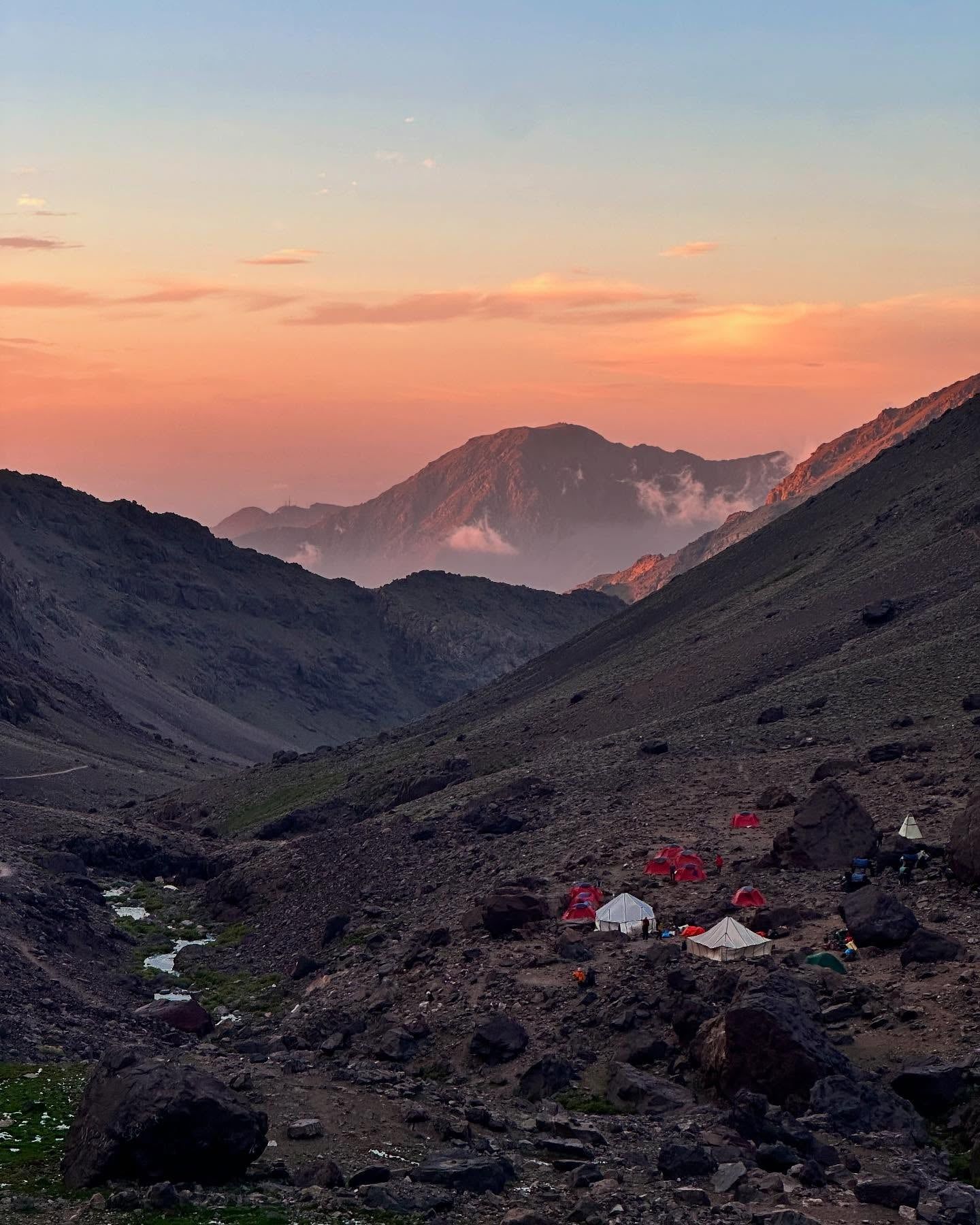
Mount Toubkal anchors the cultural identity of the local Berber (Amazigh) communities. The mountain represents physical resilience, mirroring the harsh, high-altitude lifestyle of the villages built into its slopes. Farmers in Aroumd rely on the mountain's snowmelt to irrigate terraced plots of walnuts, cherries, and almonds. Donkeys and mules transport goods along the narrow, stony pathways, preserving a traditional agricultural system that has operated for millennia. Visitors watch farmers tending agricultural plots exactly as their ancestors did, surrounded by stone-built houses that blend into the rocky landscape.
The pastoral shrine of Sidi Chamarouch sits directly on the main trekking route, drawing both local pilgrims and international hikers. This white-painted stone structure rests beneath towering rocky cliffs beside a rushing mountain river. Local Muslims travel here to seek blessings and healing, crossing a specific stone bridge to access the holy site. Non-Muslims cannot cross this bridge or enter the shrine. Tourists must respect this religious boundary and view the structure from the designated trail.
Tourism has reshaped the local economy, shifting focus from pure agriculture to mountain guiding and hospitality. Hundreds of Imlil residents now work as licensed guides, muleteers, and refuge staff. Visitors must respect local Islamic traditions by dressing modestly in the villages and asking permission before photographing residents. Carry small denominations of Moroccan Dirhams to tip the muleteers who transport heavy gear up the steep 40-minute trail to Aroumd.
Mount Toubkal ranks 27th globally in topographic isolation, standing completely detached from higher peaks.
On clear mornings, climbers standing at the 4,167-meter summit can see all the way to the Sahara Desert.
Heavy luggage is transported from Imlil to the higher village of Aroumd using traditional mule trains.
Between November and March, the upper mountain freezes solid, requiring crampons and ice axes for survival.
The historic Neltner Refuge sleeps up to 27 climbers in a single tight dormitory room.
Guides strictly prohibit cotton clothing on the mountain, as it retains sweat and causes hypothermia in freezing winds.
The white-painted Sidi Chamarouch shrine on the trail is strictly off-limits to non-Muslims.
Mount Toubkal stands at 4,167 meters (13,671 feet) above sea level. This elevation makes it the highest peak in Morocco, North Africa, and the Arab world.
Yes. The Moroccan government requires all hikers to hire a licensed local guide. Police checkpoints along the trail from Imlil enforce this rule and will turn back unguided climbers.
The standard trek requires two days. Hikers walk 10 kilometers from Imlil to the mountain refuge on day one, then complete a 17-kilometer round trip to the summit and back down on day two.
The Neltner Refuge is a mountain hut located at 3,207 meters on the Toubkal slopes. It provides dormitory-style beds for up to 90 climbers and serves hot meals like tagine.
Non-Muslims can hike past the settlement and view the white-painted shrine from the trail. However, they are strictly prohibited from crossing the stone bridge to enter the religious site itself.
Winter ascents between November and March require specialized mountaineering equipment. Climbers must use crampons and ice axes to navigate solid sheets of ice above 3,500 meters.
A standard two-day guided trek costs between 1,500 and 2,500 MAD (150 to 250 EUR) per person. This price generally covers the guide fee, refuge accommodation, and basic meals.
There are no ATMs in Imlil or anywhere along the trekking route. Hikers must bring sufficient cash in Moroccan Dirhams or Euros to pay for snacks, tips, and souvenirs.
Many climbers experience mild altitude sickness due to a 40% drop in oxygen levels near the summit. Symptoms include headaches, nausea, and fatigue, which can be mitigated by walking slowly and drinking plenty of water.
April to May and September to October offer the best climbing conditions. During these spring and autumn months, temperatures are moderate and the weather remains relatively stable.
Browse verified tours with free cancellation and instant confirmation.
Find Tours